[FUNCTION AND RESPONSIBILITIES]
[CURRENT ACTIVITIES, RESEARCH AND DEVELOPMENT]
INTRODUCTION
In the past Meteorology was first introduced to Thailand by Royal Thai Navy. They recognized the importance of meteorology for more advanced navigation. After that, the Department was transferred from the Royal Thai Navy to the Office of the Prime Minister. Awareness of both the increasing importance of the application of meteorology to various fields of human activity, particularly agriculture, water resources development, land transportation, shipping and aviation, and the increasing responsibilities of many Government units under the Office of the Prime Minister, resulted in the Meteorological Department being transferred from the jurisdiction of the Prime Minister to that of the Ministry of Transport and Communications on 1 October 1972.
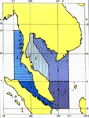
Boundaries of areas used in weather bulletins for merchant shipping and coastal weather
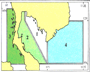
Tropical cyclone warning areas of responsibility
Marine Meteorological and Upper-air Observations is assigned to a sub-division of Meteorological Observations Division that has consisted of 2 sections, those are observation section and technical support services section. Marine Meteorological and Upper-air Observations sub-division currently has a complement of 10 staff comprising of 1 chief of sub-division, 2 graduate officers and 7 class III officers.
FUNCTION AND RESPONSIBILITIES
The observation section has
- observed marine meteorological data
- checked data quality control before marine meteorological data are sent to the Data Processing Sub-division under the Climatology Division.
The technical support services has
- studied air-sea interaction phenomena related subjects
- analyzed marine meteorological data.
- processed marine meteorological data.
- prepared and issued waves forecasts to
CURRENT ACTIVITIES, RESEARCH AND DEVELOPMENT
In the past TMD used to Collaborate with GISTDA (formerly as National Research council of Thailand) to measure marine meteorological data by using moored buoys in the Gulf of Thailand and Andaman sea.
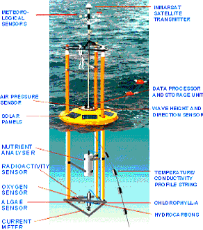
Moored buoy
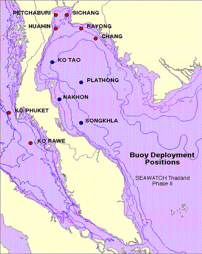
Location of Buoys
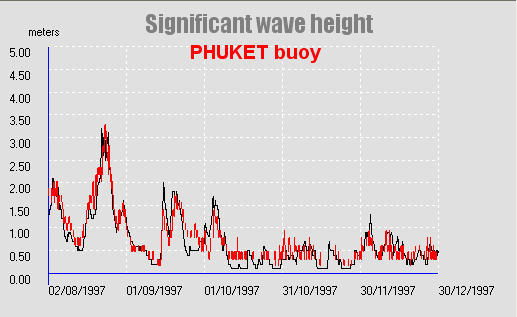
Comparison of ocean wave model with Significant wave height at Phuket buoy.
To study significant wave height by using radar altimetry on TOPEX/Poseidon satellite, which the ocean will reflect the radar beam back to the satellite. Since the radar beam travels as fast as the speed of light, the amount of time that is takes the radar beam to get back, tells the satellite the height of the oceans.
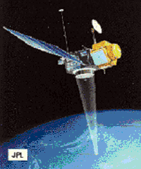
TOPEX/poseidon satellite
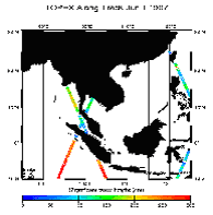
TOPEX Along-Track
Continously running and enhancing Numerical Wave Prediction models (WAM) that have been produced and implemented to improve the quality of forecasts by comparison with moored buoys and oceanography satellite.
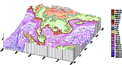
Topography
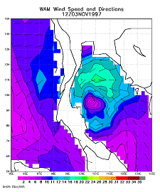
Wind field at 10 meters from NOGAPS
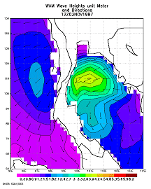
Significant wave height from WAM model
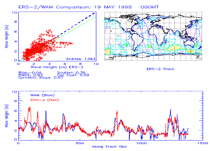
Comparison of ocean wave model with satellite data.