ABOUT US
WEBBOARD
PHOTOs
BEAUFORT SCALE
Marine Met Service
STAFF
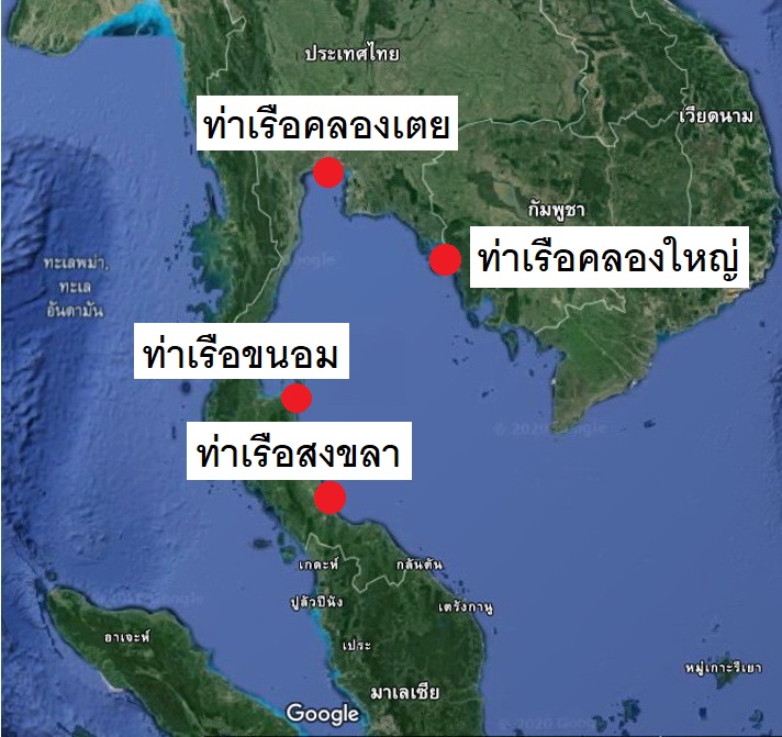
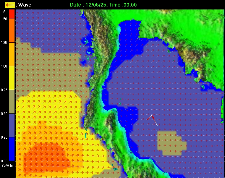
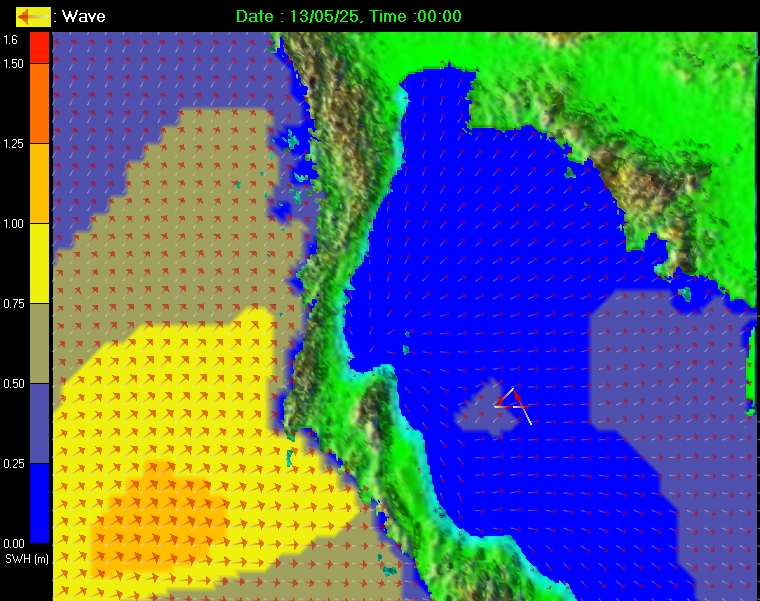
Wave Forecasting at the main harbor
for commercial and disaster surveillance in the Gulf of Thailand
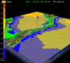
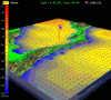
[Ocean wave model for WAVE2D - Click here]
[Ocean wave model for WAVE3D - Click here]
[Shipping Bulletin]
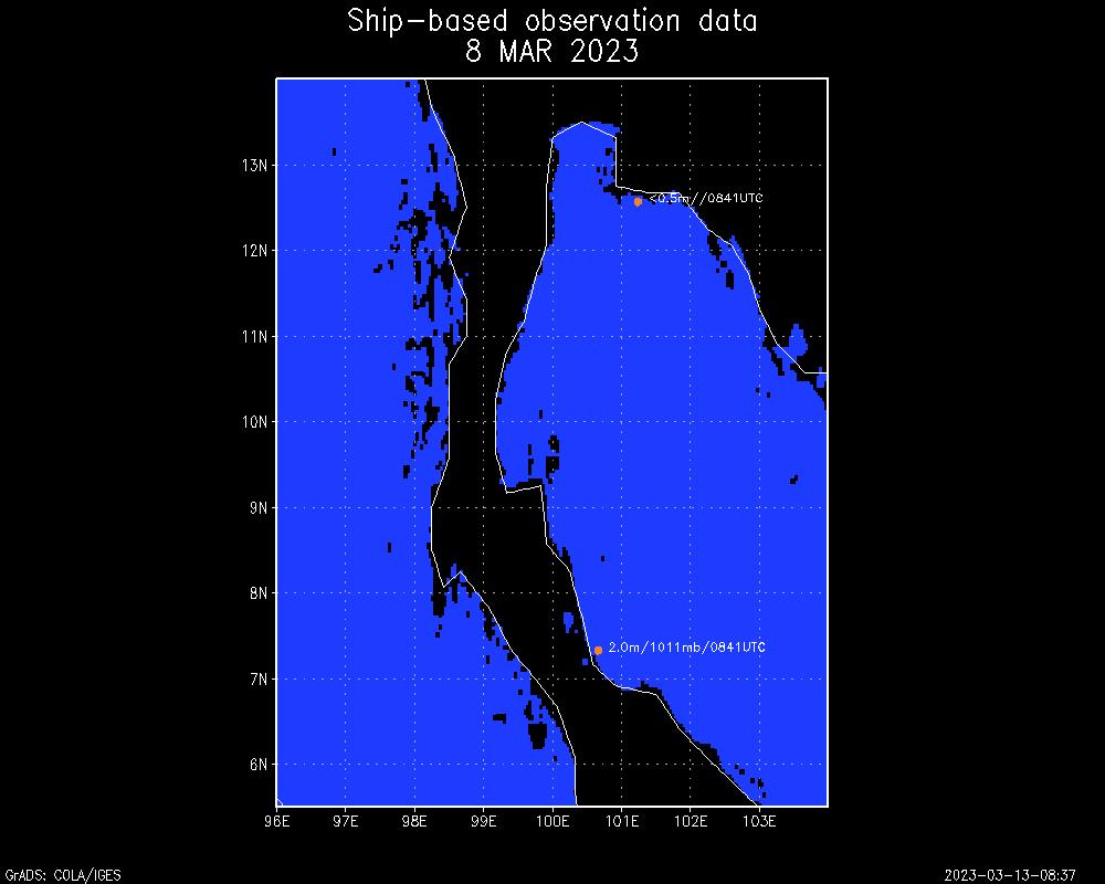
[Marine observation from Ships via GTS system]
[Significant wave height chart from ships via GTS ]
[Marine observation from Chevron]
Ship-Based Observation Data
Cooperated with National Telecom Public Company Limited
Meteorological Simulation of Cyclone Nargis
Powerpoint Type
Java Script Type
Technical Presentation
[ - Transformation of Shallow-Water Waves
[ - Tsunami Simulation for the warning and risk evaluation
[ - Siam Tsunami Propagation Simulator Model
[ - Numerical storm surge prediction model
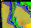
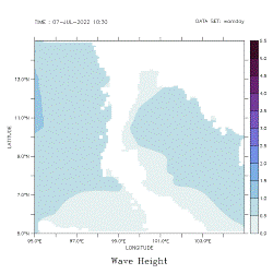
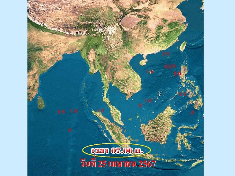
Daily Average Wave Height
[ NUMERICAL OCEAN WAVE FORECAST]
[ NUMERICAL WEATHER PREDICTION ]
[MARINE METEOROLOGICAL REPORT]
Copyright 2004 by Thai Marine Meteorology, All Rights Reserved.For More Information. Please Contact wattkan@gmail.com
 Copyright
2004 by Thai Marine Meteorology, All Rights Reserved.
Copyright
2004 by Thai Marine Meteorology, All Rights Reserved.


